A lot of people think that mountains around Hong Kong are not stimulating. Most trails are well paved and the way up is usually just stairs. However, spend a good one hour out to Sai Kung, and you’ll get to appreciate the beauty of hiking in Hong Kong. Sharp Peak is definitely one of those surprises. As its name implies, Sharp Peak is the steepest mountain in Hong Kong, therefore the most challenging. It is not paved and for most parts, you actually have to get down on all fours to literally climb up. It is a test of physical fitness, mental perseverance and problem solving. Once you pass this test, you can pretty much hike any mountain in Hong Kong.
Duration: 3-4 hours (one-way)
Difficulty: 5/5 (probably even a 6)
Views: 5/5
This hike is definitely something you can’t take lightly on. Preparation is a must. Do bring a few friends along to hike with you in case you feel exhausted at any point during the hike. I brought 4 bottles of water up last time, and I still felt it wasn’t enough. So do bring loads of water to keep yourself hydrated, especially on a hot summer’s day.
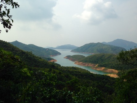
To get to the start of the hike, take minibus 1A from Choi Hung MTR Exit C1. Get off at the final stop – Sai Kung Ferry Pier. From then onwards, you can either take a cab or bus 94 to the beginning of the Sai Wan trail. Follow the sign and you’ll walk through a very nice gentle path till you get to Sai Wan Beach. Along the way, you’ll see nice small islands in the middle with a nice reservoir in the middle.
There are small huts selling snacks and beverages at the beach if you need to refuel yourself. Carry on forwards for another good 20-30 minutes, you’ll reach another set of beaches – Ham Tin Wan and Tai Long Sai Wan. You’ll be amazed by how fine and natural the sand is at these beaches. In the distance, you’ll begin to see a glimpse of Sharp Peak just “peaking” out behind other hills – yes, it looks steep. But don’t fear – being slow and steady will get you up the hill. Follow the sign leading to Pak Tam Au, and with another hour of gentle walking, you’ll see the steps leading towards Sharp Peak on the right.


Conquering the 4 peaks
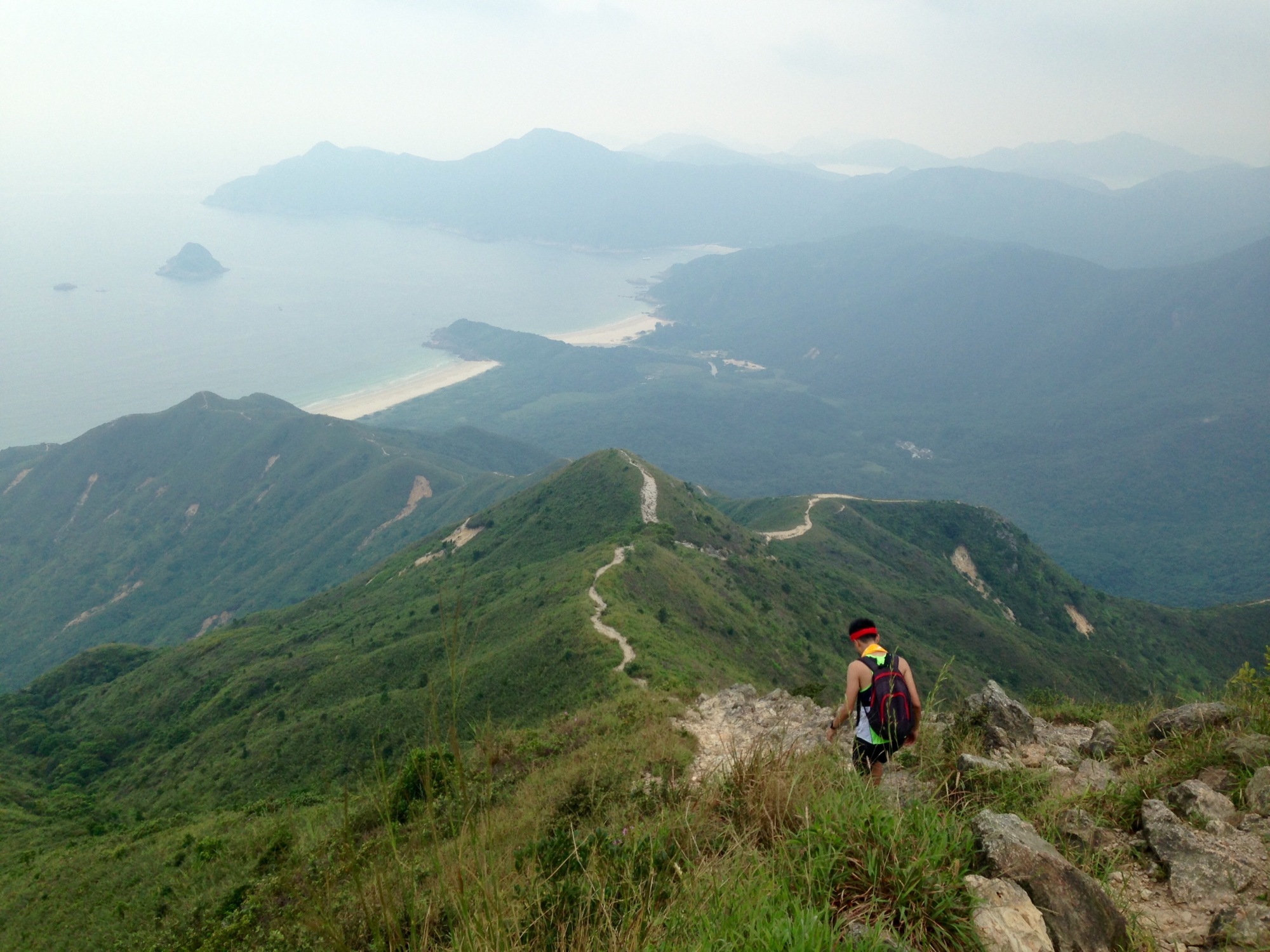
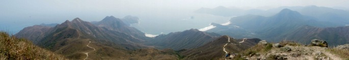
There are 4 peaks that you’ll have to climb before reaching the top. Take them steadily. Be strategic, and don’t tire yourself on the first peak. There will be many loose rocks along the way so be careful on which route to take upwards. The second peak is the hardest to conquer – it is as if you are going vertically upwards. Grasp onto the rocks firmly, and pull yourself up. It is going to be tough. I usually don’t look up, because it is quite daunting sometimes to see how much left you still have to hike up. So just focus on what’s in front of you, and climb those rocks slowly. Do take breaks in between – it’s virtually impossible to climb the whole thing in one go without resting. Take some time to look backwards and admire the magnificent mountain ranges of Sai Kung – it’s limitless. The bare trail looks like that of Dragon’s Back – but definitely a lot longer and impressive.


A good 45 minutes of upward hiking will take you to the very last peak, and you’ll be there! Surrounded by more hills, more sea and more beaches – everything is just so different from the typical hikes in Hong Kong, such as the Lion Rock, where you’ll most likely be hiking next to tall skyscrapers or power stations. The peak is chilled, and it’s the place to sit down and have your lunch before heading back down.

A slippery slide
You may think that your nightmare is over having climbed all those rocks and using up all your stamina, but it hasn’t ended yet. Imagine all that steepness you’ve overcame, well you have to do it all again, but downwards. It’s steep and a lot scarier. There will be loads of loose rocks, and you’ll definitely slip at least once. Just hold on to the big and study rocks, and balance your way down slowly. If you want to chill at Tai Long Sai Wan instead of going back to the original route, there’s a path diverging out on the left that will lead you to the beach.

Once you get to the bottom of Sharp Peak, turn right and continue walking along the sign that leads to Pak Tam Au. A 1 hour of steady walking will bring you to the end of the trail and onto the road.
At Pak Tam Au, you can take bus 94 back to Sai Kung Ferry Pier. There may sometimes be minibuses along the road that you can flag and hop on – they will also lead you to Sai Kung Ferry Pier. Feel free to spend some time exploring Sai Kung as it is a very nice place to have some seafood and there are many decent local cafes! If you still have the energy, you can also go kayaking, windsuring or paddle boarding for a pretty reasonable price!
Note: The photos of the hike may not look as difficult as I described. But trust me, it’s tough!

This is amazing and it certainly looks like the views were worth it!
LikeLiked by 1 person
Great instructions and top post! 🙂 Definitely the toughest climb in HK!
LikeLiked by 1 person
Thanks Clement! Please check out his vlog everyone: https://m.youtube.com/watch?v=HrsYHldHdzc
LikeLike